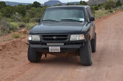
Trip Report: Overland Expo to Moab May 2015 | Ford Explorer Forums - Serious Explorations

  • Register Today It's free!

Trip Report: Overland Expo to Moab May 2015

Brian1

Elite Explorer
Joined
February 2, 2000
Messages
5,387
Reaction score
643
City, State
Albuquerque, NM
Year, Model & Trim Level
1991 XLT
Callsign
KG5BAQ
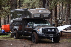
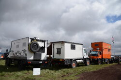
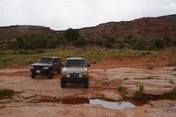
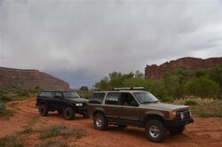
[MENTION=63829]Tbars4[/MENTION] and I met up in Flagstaff a few weeks ago to attend the Overland Expo West. The Expo was a big gathering of all things Expedition and Overland related and was held at Mormon Lake, AZ just South of Flagstaff.

It was a wet and muddy mess but I had a good time seeing friends, vendors and several of the presentations and classes.

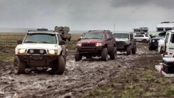
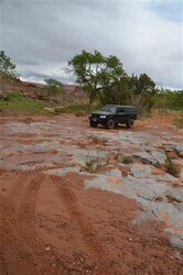
Many of the campers left early providing entertainment from my camp spot. 3 vehicles chained together to pull out an Earthroamer and heavy equipment and a military 6x6 was busy pulling out trucks and RVs
 

Attachments

  • expo1.jpg
    expo1.jpg
    49.9 KB · Views: 1,096
  • expo2.jpg
    expo2.jpg
    71 KB · Views: 451
  • DSC_4683.jpg
    DSC_4683.jpg
    78.4 KB · Views: 374
  • DSC_4687.jpg
    DSC_4687.jpg
    96.4 KB · Views: 488
  • DSC_4575.jpg
    DSC_4575.jpg
    48.7 KB · Views: 387


Join the Elite Explorers for $20 each year.
Elite Explorer members see no advertisements, no banner ads, no double underlined links,.
Add an avatar, upload photo attachments, and more!
.


Trail Day 1

We left Monday morning from the Expo and went to Mexican Hat Utah where we fueled up and then hit the first trail just 5 miles outside of town. It was Johns Canyon that has been on my to-do list for quite some time. It is an in and back out trail, about 18 miles each way. Mostly easy graded road, slightly rough shelf road and some slickrock and sandy sections with 2 waterfall crossings.

The storm moved in and we turned around and went back out. We found a sheltered campsite in Valley of the Gods for the night.
 

Attachments

  • DSC_4862 (Small).JPG
    DSC_4862 (Small).JPG
    94.2 KB · Views: 397
  • DSC_4885 (Small).JPG
    DSC_4885 (Small).JPG
    81.7 KB · Views: 485
  • DSC_4890 (Small).JPG
    DSC_4890 (Small).JPG
    68 KB · Views: 428


Trail Day 2

We got up and got moving from our Valley of the Gods campsite around 8ish and took the highway towards Comb Ridge and up and over the highway cut through the Ridge dropping down to the other side. We pulled into Butler Wash which is on the East side of Comb Ridge to start the day.

We had both done this wash on a previous trip so I had 1 thing on the agenda for this trail and that was a stop and hike to Fishmouth Cave.

We parked and hiked the 1 mile up the canyon seeing several ruin sites along the way. Finally reaching the cave we took 2 separate routes up to the top, the hiking path was a little hard to find in spots especially near the top. The view out the cave was great!

DSC_4952_zpsugj6j4mq.jpg


We hiked back to the vehicles and had lunch. Continuing up Butler Wash it started pouring rain and hail making it a bit muddy. We reached the end and waited out the storm at a rest area pull out for some "touristy" ruins.

Once it cleared another trail on my adgenda was Poseys Trail which goes up the old highway cut in Comb ridge and pops out on top of the ridge. We got to the beginning and things didn't go so well. I started going up and the ground started collapsing under my tire in a rut. I backed up and chose a different line and we kept going up the shelf road until we reached maybe half way up and I ran into a rockslide partially blocking the trail. It was too mudy to go around without serious body damage so we both had to back down the shelf road until we could make a few point turn around and head back out to the highway.

From there I decided to head to Cedar Mesa and the 7 Towers site to make camp and explore the area the rest of the day.

We got to the end of the short spur road off the highway and hiked in the last tenth of a mile to the towers site. The towers were around the rim of a large canyon. We looked around and then scrambled down the canyon below to the spring and another ruin below the rim.

DSC_5067_zps3bnxnomi.jpg


We returned to camp and that was it for trail day 2.
 

Attachments

  • DSC_5025 (Small).JPG
    DSC_5025 (Small).JPG
    118.1 KB · Views: 431
  • DSC_4933 (Small).JPG
    DSC_4933 (Small).JPG
    98.6 KB · Views: 423


Trail Day 3

This was the day I was most looking forward to! We broke camp about 8 and drove back to the highway and a very short pavement section later we turned and crossed the other side of the road to the Mule Canyon trailhead. This is a fee area so we both paid our $2 for the day and then parked at the trail.

DSC_5094_zpspap11r69.jpg


DSC_5107_zpsx4afkmzt.jpg


1 mile hike in and we came to house on fire ruin. The light wasn't too good yet so we kept hiking another mile up the canyon before turning back around. The House on Fire is a very cool ruin because of the fire effect. It is also a very popular spot, I think I counted 25 people while we were there and remember this is 1 mile up a canyon!

DSC_5129_zpsebuv5m7c.jpg


We left the canyon and drove down Cedar Mesa and then over the Comb Ridge cut and stopped at a small pullout for another hike to Target Ruin. Unfortunately we never found it but now that I have looked it up I know where to turn the next time. This hike was about 1 mile in and we did find a few very small ruin sites but nothing as cool as Target Ruin was supposed to be.

DSC_5147_zps9je0vb0u.jpg


DSC_5149_zpsmx0tgjdy.jpg


We returned back to the vehicles and went to Blanding to refuel and pick up some supplies.


Day 3 Continued

From Blanding it was starting to get late and we had a long way to go to our next camp for the night in Beef Basin. We took the highway up to Monticello and then dropped into the valley and took the turn to the Canyonlands Needles District. We came to Newspaper Rock and stopped to check it out

DSC_5152_zps22lloc6c.jpg


DSC_5153_zpswoeh09a1.jpg


DSC_5155_zpsswlc6hd6.jpg


DSC_5156_zpsbmwuqmlz.jpg


From there we continued another 7 miles and turned off to Cottonwood Canyon. This was a dirt road for the most part that started off going through tall red canyon walls before climbing in elevation up to 8000 ft in the mountains. The road was very rutted up from the mud days or weeks earlier. It was dry for us. After 30 miles on dirt we came to the turn for Beef Basin which dropped fairly quickly to about 6000ft with some great views.

DSC_5169_zpsm0qcatx3.jpg


DSC_5171_zpsghn9xldg.jpg


DSC_5172_zpsern7oqf9.jpg


DSC_5176_zpsxjcprstg.jpg


We paused at a trail marker sign briefly and decided where to camp. My GPS showed a long spur road a few miles ahead in Ruin Park so we took that and found a great site for the night. This area was known as middle park. There were a few small ruins way up the cliffs near us but we didn't explore them. It was late so we fixed dinner and set up camp quickly.
 

Attachments

  • DSC_5180 (Small).JPG
    DSC_5180 (Small).JPG
    99 KB · Views: 375


Day 4

It was Thursday and the 4th day of our trails and also 1 week that I had been on the road camping out of my Explorer.

Today we explored another area that had been on my to-do list for a long time and that was Beef Basin. I wish I had a few days in this area as there is so much to see and do. Moab can be reached from here with only a small stretch of pavement with over 100 miles of dirt but that will have to be saved for another trip.

We left Middle Park very early in the morning for a few reasons because there was a lot to see and we wanted to get back over the mountain before the forecasted afternoon storms came through.

We went up Ruin Park towards Bobbys Hole and Elephant Hill and checked out a few ruins including a tower and Farmhouse. These ruins are different than the others we saw earlier in the week because they lie in an open basin and not in high up in a canyon area. These were more for farming than for defensive sites.

DSC_5191_zpsmpjjyzfc.jpg


DSC_5203_zps5wxeb8z2.jpg


DSC_5207_zpswtkj4jqc.jpg


We turned back and went into the Beef Basin loop where we saw a few more ruins and where I almost stepped on a Rattle Snake to get a closer look at one of the ruins :eek: . it was laying out partially covered in some rocks at the base of one of the ruins.

DSC_5217_zpsiq8nb4cg.jpg


DSC_5219_zpszl6h9iu3.jpg


DSC_5220_zpsyfg4lobj.jpg


DSC_5222_zps2hejzs3z.jpg


We left Beef Basin and went back up the mountain and back through Cottonwood Canyon. Almost at the end Tbars lost his coil spring so we stopped for a trailside repair. Back to the highway and we drove all the way to Moab to get settled in for the Explorerforum meet.

A great trip with lots of hiking and seeing some cool places. I cant wait to get back to the area and see what else the area has to offer.
 

Attachments

  • DSC_5223 (Small).JPG
    DSC_5223 (Small).JPG
    102.3 KB · Views: 413


...I started sorting pictures...Hope to post some this eve..:biggthump


...Thanks Brian...:biggthump

..A simple assignment turned into several simple assignments...;)

...and I get to enjoy your pictures too..:popcorn:


...You might recognize most of the area we traveled in this video that popped up today as the Government may be turning this into a "National Monument"..:(

http://www.ksl.com/?sid=35651522&nid=


This sounds like the same area featured in the latest Overland Journal.

Yes, very similar. We ran short on time or we probably would have done Elephant Hill like they did as well. They also had to turn around on poseys trail switchbacks so that rockslide has been there for a while.


DAMN, this looks like an amazing time. I would love to do a trip like this.


Back
Top