Anyone in St. George? | Page 4 | Ford Explorer Forums - Serious Explorations

  • Register Today It's free!

Anyone in St. George?

More pics
 

Attachments

  • P1020410.JPG
    P1020410.JPG
    94.5 KB · Views: 162
  • P1020422.JPG
    P1020422.JPG
    124.7 KB · Views: 175
  • P1020431.JPG
    P1020431.JPG
    111.5 KB · Views: 219
  • P1020435.JPG
    P1020435.JPG
    129.8 KB · Views: 163


Join the Elite Explorers for $20 each year.
Elite Explorer members see no advertisements, no banner ads, no double underlined links,.
Add an avatar, upload photo attachments, and more!
.


More pics. The one approach pic shows how steep it is.
 

Attachments

  • P1020475.JPG
    P1020475.JPG
    115.6 KB · Views: 188
  • P1020469.JPG
    P1020469.JPG
    104 KB · Views: 164
  • P1020450.JPG
    P1020450.JPG
    127 KB · Views: 164
  • P1020448.JPG
    P1020448.JPG
    120.6 KB · Views: 165


last ones. Have many more but picked some of my favorites.
 

Attachments

  • P1020488.JPG
    P1020488.JPG
    102.4 KB · Views: 166
  • P1020490.JPG
    P1020490.JPG
    107.3 KB · Views: 170


Good looking pics. We have done our share of rock climbing. Hotel Rock, Elephant Hill, Hole-In-The-rock, Grand Bench(Rec. Rd. 262) just to name a few. If you'd like to put something together for Friday the 24th or Saturday the 25th I'll try to make it I have to leave for home on Sunday the 26th.


Alright. I hope to make it down to st. george soon. For me living within a day's drive of st george, I have never been.


We were in the area the 15th,16th &17th. Found and ran what we could of the Honeymoon Trail to St. George and then most of the Temple Trail to Mt. Trumbull. The maps I had made it difficult to find the trail in the ATV play area just east of Ft. Pearce. I made it through but really wanted to do some more exploring in the area and try to find the exact original road. The 17th we finished up down at Mt. Trumbull and went on down to Toro Weep and back to a campsite near Mt. Trumbull. The 18th we split up and I went back to the Vermillion Cliffs with a guy who wanted backup exploring a sandy section. Was considering heading back to St. George to do more exploring but saturday night at camp I had trouble with my tent (still need to make a permanet repair before another trip). The tent survived the night but the next morning "Green" (my 94 Sport) had a flat. I put the spare on and headed for Page. I decided that two problems in less than 12 hours was warning enough. Headed home and hoped the third didn't show up or if it did I would be on a main road with cell service. Made it home monday evening and stoped to eat before going to my house. When I came out the tranny wouldn't go into to reverse. Looks like I made the correct choice.

That shore is purdy country out that way. I want to go again and do some more exploring or maybe find some one who knows the exact route of the original Honeymoon and Temple Trails around Ft. Pearce.

Word has it that the write up on the Temple Trail will be in the April 2011 4Wheel Drive & Sport Utillity Magazine out the first part of Febuary. Then there will be a 2 part story on the Honeymoon trail. Should be a few pics of Green should anyone want to see pics of a 1st gen out on the trails.

I am really streached thin getting Jr. (my 88 BII) and Green ready for a May trip to do HITR with my sons. But if folks want to do the Temple and Honeymoon trails and explore the original routes I'd really like to go back. My friend who did the write up wants to do the Butterfield Stage route in a year or so. Maybe on the way back home from CA after that. Hows that for a kinda maybe sorta thing.


I received my April 2011 issue of 4Wheel Drive & Sport Utility magazine yesterday. It has the first of 3 stories in it of when we were there in September. First story is on the Temple Trail. Should be on the news stands and if not will be shortly. There is talk of going back already.


let me know dates ill try to make it!


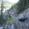
I don't even know if I'll be invited or not. Rumor is the editor is going to take some semi rock buggies out and go up the book cliffs where the trail actually went. And there are some pretty nasty sections that are by passed the "new" road.

Neal (Muley), the guy in the white toyota in the story told me about the map of the trail. I used it and an old Delorme 3D Topo program to map the route. Neal and I were going to pre run that for Larry (Lonerider) but he stuck around when he got the sent of the trail. The map uses the same color line for the Temple and Honeymoon Trails and they cross and are the same for some near Ft. Pearce. I'd really like to go back and map as much of the parts we missed.

So of this is very difficult to extreme. Larry writes for folks with stock to slightly moded trucks. In our younger days we could do the work to get stock/semi stock trucks up over very difficult sections. But we are old and hurtful and don't have anything to prove. So we have little need most of the time to beat on ourselves and our trucks.

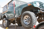
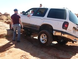
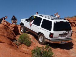
I do have a Bronco II with 44 front, 9" rear, Detroit Lockers in both, 6" lift, C-5/doubler, and winch. I just want to map the trail. Guess I need to find a younin ta move rocks and cliomb up and hook up the winch cable. I don't even care about driving if someone wanted ta drive "Jr." (my 88 BroncoII)

If anyone knows about or can connect me to someone out that way that knows where the complete trail(s) are I'll buy ya dinner.


Back
Top