gwnf recon
greetings,
i just made two passes through the gwnf on my way to and from Chicago. when i did, i spent some time with my maps and GPS seeing what i could find electronically. When i went through the "dry river" (for lack of a better name)and brandiwine areas i took special note to look for wheelin areas. i was surprised to see how many there were (probably a dozen or more access points) and they all seemed moist if not muddy. Additionally i saw a major local swimming hole (probably 20 cars parked there).
i know in the past we have usually done the second mountain thing then busted butt to get back to Richmond, and it has usually been in the cooler parts of the year. Last time we went over to the dry river section and went in at the one of the eastern most access points. There are a lot more access points west of there. I am thinking that even if it is hot then making it a saturday overnighter might be a good idea maybe cooling off in the dry river etc.
i also scoped out a series of forest roads (on the topo software) on the south side of 33 around the store at rawley springs. They might be worth exploring as well.
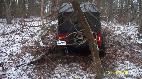
Anyway... the area seems to have lots of promise but unfortunatley i didnt get to check out any of the wheelin spots since i was driving the thunderbird.
I am thinking about doing a recon weekend in advance of whatever forum trip that you will be doing later in the month i am thinking about saturday 8/16for a recon run. i dont know what we will find, so it best that we do not take a large group on this one.
Probably leave early sat. get there and pick out a base camp site near some sort of water then just checking out the access points in the area, kickin around for the day then heading back home sunday morning.
if/when you do shoe creek/stoney run etc. We can make it an overnighter at my place. i plan to rent a backhoe to make my trails more difficult by then. The AC will be working in the shed/cabin by then as well, and of course there is the swimming in the James.