Sinjin PEZ
Member
- Joined
- January 23, 2000
- Messages
- 17
- Reaction score
- 0
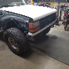
I remember a while back some one saying something about a offroad place here in Texas, and i started asking around, and got the directions from the organizer of a Jeep club here in town, id really like to check it out, whoooosss coming with me?
Jason wrote:
The below info should give you everything you need...If yuo have any other
questions, feel free to ask anytime.
Jason
Hwy 35 and Hwy 10 both run into San Antonio. So if you are coming from out
of town on one of those hwy's take Loop 410 west and follow it around to
exit 11 (Ingram Road) and go outside the loop. Go to the first light (Ingram
Park Mall - on your right), turn left (yes it's also called Ingram Road) and
go straight thru the next light. As you past that light you will cross a
bridge and on your right you will see a paved entrance(Do not take this one)
just keep going to the very next low water crossing (entrance on your right)
and you are at the beginning of the Den. The trails go back for approx. 3
miles and there are many obstacles to try your vehicle on from hills, to
rocks, ledges, mud holes and just riverbed rock. It's best to go with
someone who knows the area, especially if it has just rained. There are some
deep water holes that will swallow you up.
Please do not go here after dark or drink alcohol while wheeling out here,
the police and news media do not need any more reasons to make us look bad.
Here are some GPS coordinates to the local hot spots on the trails.
Tim's Rock - 29*28.05 N 098*37.83 W
Todd's Creek - 29*28.26 N 098*37.96 W
Universal Hill - 29*28.40 N 098*38.00 W
Axle Breaker Hill - 29*28.55 N 098*38.16 W
Huge rock to play on - 29*28.63 N 098*38.18 W
Continue on the trail/riverbed and you will come to a bridge (Grissom Road)
you can exit here and get gas and snacks. The Grissom side is a very wide
rocky section that is fun to play on and get all flexy on. There are no set
trails to stay on, so just try all the rocks out and enjoy : )
Dirt Bank Grissom side of the Den - 29*29.38 N 098*38.25 W
Rock Creek section Grissom side of the Den - 29*29.83 N 098*38.26 W
RTI Ramp looking trees just for general purposes - 29*29.97 N 098*38.22 W
UPS exit Grissom side is currently closed and so this is the turn around
point - 29*30.23 N 098*38.06 W You are now actually 2.90 miles from the
entrance to the Den.
-----Original Message-----
From: Rod [mailto:kwalkins@austin.rr.com]
Sent: Thursday, February 10, 2000 1:32 AM
To: jbeer@austin.rr.com
Subject: Devils Den?
So it looks like we have no excuse not to check this place out, anyone wanting to go place contact me or post here, and maybe we can set up some dates.
kwalkins@austin.rr.com or
rodney_guajardo@dell.com
------------------
Sinjin PEZ
www.enjoy-pez.com