Ken Cooke
Explorer Addict
- Joined
- April 18, 2000
- Messages
- 1,365
- Reaction score
- 0
- City, State
- Riverside, California
- Year, Model & Trim Level
- '03 Rubicon - Tomb Raider
Located 14 Mi. east of Twentynine Palms south of Hwy 62 is the
magical region named the Dale Mining District. Mining was a
moneymaker in the 1880s, and crushed rock trails were constructed to
move the operators in and out of the region. Although faint
footpaths line the walls which are covered with cactii and creosote
bushes, the rough, rock-lined paths dominate this region, and provide
access to mines bearing names like; Virginia Dale, Golden Egg,
Duplex, Supply, Rose of Peru, Brooklyn, Los Angeles, and even O.K.
I have been traveling to this region in my 4WD Ranger, and lately
my '03 Wranger Rubicon since 1998, and I would like to share my
knowledge of this backcountry with whomever is interested. On
November 5th and 6th, 2005 I will lead a group of 4WD vehicles with
good tires (and a hearty spare), CB radios, and a sense of adventure
over a majority of these trails.
4WD Travelers Advisory:
On October 1st, our group attempted to reach a large number of
mining trails, but were slowed to a crawl by a number of washouts,
and boulders blocking our path. These trails have taken a serious
beating recently thanks to Mother Nature (not the 4WD community!),
and it is advisable to carry along a good pair of heavy work gloves
and a sturdy shovel. Road building may be a possiblity out on the
trail all weekend long. Some trails may require backing down steep
and off-camber sections of trail to flat ground.
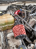
These trails contain a series of sharp rocks that may harm your
tires sidewalls. On this trip, two of my Super Swamper TrXus tires
were damaged and need replacement. One Big O XT had a lug completely
sheared off the tread section, and a Pro-Comp XTerrain tire obtained
a sidewall puncture. It is absolutely essential to carry along a
HiLift Jack and a trusty spare tire in order to continue down these
rocky paths. A mounted clinometer will provide pitch and camber data
for those with high center of gravity.
Overnight Camping:
This two-day run will include camping in the backcountry. It is not
required or mandatory that participants also camp out in the backcountry.
When our group completes our last trail at approximately 4 p.m., we will
simply set up camp. Because of the rough terrain, motorhomes cannot
negotiate the sandy, dirt roads. This will be a bobtail campout where
travelers will need to bring their own water, and toileting facilities.
**There will be no toilets, drinking fountains, or public restrooms of any
type once we leave the Cottonwood Visitors Center on Saturday morning.
Please bring a log or two of firewood, and your own camping gear.
Nighttime temperatures will be mild for this time of the year, which should
make for pleasant camping weather.
**We will camp in Bureau Of Land Management land and not the National Park
on Saturday night.
Christmas/Hannukah/Kwanza Shopping at Joshua Tree National Park:
The Cottonwood Visitors center contains a readily available
assortment of mining books, maps, hats, t-shirts, puzzles, videos and
DVDs, and tourist literature which would make a great holiday
surprise for your friends, children, neighbors, and trail boss. Be
sure to stop in the Visitors Center early, and take a look at what is
available for purchase. Get your holiday shopping done early.
Important Data:
Trail Boss - Ken Cooke (a.k.a. "Desert Outlaw")
Trail Ratings: Level 3 to 3+
Camping Type: Bobtail (Dry) Camping
Trails: Old Dale Rd., Brooklyn Mine Trail, O.K. Mine Trail, Carlyle
Mine Trail, Geology Tour Road, and Berdoo Canyon Road.
Text: Backcountry Adventures: S. California - Massey & Wilson
South Coast #41 & #42 pp. 411-418.
email: thedesertoutlaw@yahoo.com
CB Channel 4 - cell phone # (951) 255-1589
Meeting Place - Cottonwood Visitors Center, Joshua Tree National Park
[DIRECTIONS]
* Take I-10 approximately :45 past Palm Springs, CA. Last chance to
gas up at Dillon Road near I-10 and 86 South.
* Continue East on I-10 for approximately :20 more minutes to the 29
Palms/Mecca Exit (Hwy195).
* Exit traveling North :10 more minutes to enter Joshua Tree
National Park.
* Stop at Cottonwood Visitors Center & Purchase $10 park pass (valid
7 days).
Trail Info:
Drivers Meeting Time - 9 A.M. in front of Cottonwood Visitors Center
Drivers Departure Time - 9:15 A.M. (Please be on-time)
Trail Rating 3/possible 4+ for running trails through Brooklyn Mine Canyon.
1 full tank is enough to complete Saturday runs.
One to two Jerry cans recommended for complete weekend.
On Sunday afternoon, we will exit the park via Geology Tour
Road/Berdoo Canyon Road and obtain gas and air at the ARCO station on
Dillon Road between I-10 and Hwy 86.
We will *TRY* to hit the following list of mines, in the
approximate order they are listed:
Los Angeles Mine 34 01 55N 115 40 50W
Gold Standard Mine 34 17 52N 115 31 20W
Brooklyn Mine 34 03 00N 115 43 07W
Supply Mine 34 03 ??N 115 43 ??
Carlysle Mine 34 04 675N 115 42 160W
Iron Age Mine 34 03 46N 115 38 41W
Just Runs October 1 Joshua Tree Run Photos:
http://www.justruns.com/gallery/album228?page=1