Official Colorado Colors Run 09 - Ouray: Sept 4-7th, 2009 | Page 18 | Ford Explorer Forums

  • Register Today It's free!

Official Colorado Colors Run 09 - Ouray: Sept 4-7th, 2009

Status
Not open for further replies.
Well, bummer, I was hoping you could make it. You got cheated on a good time at Smorr. Was wanting you to make it up with a run to Ouray. :(

well gman i'll make the trip with the 2wd ex if you will stay on the front of my tow-strap :D:D:D
or i could borrow the old mans toyo and lead the front of the pack
oh change of thought bring up the rear a mile away :wavey::wavey:


Join the Elite Explorers for $20 each year or try it out for $5 a month.

Elite Explorer members see no advertisements, no banner ads, no double underlined links,.
Add an avatar, upload photo attachments, and more!
.


Last time I was there two guys on motorcycles came up to us at the overlook on the west side of Engineer. They had come up from 550 and were looking for California Pass and wanted to take Corkscrew back. I headed them the correct way but never fould out if they made it or not. I tried to show them on the laptop.

Just don't loose contact with the folks who know where they are.:D

Just for the record, I was kidding. I always have a map and compass with me.

And yes, I do plan on buying a GPS.


Just for the record, I was kidding. I always have a map and compass with me.

And yes, I do plan on buying a GPS.


I was kidding too. That's why I used the little green smilly thingy.

Yall need ta watch out fer them tree lizzards though. I'm purdy sure I seen one last week out around Breckenridge.:D


Did someone say GPS?? Here is mine

m_DSC06448.jpg


I have done probably 95% of the trails in the area, and at least half of those a couple different times but I still rely on the Wells book. FYI, the GPS coords found in the Wells book are available for download HERE I download them and then use GPS Visualizer to convert them to my GPS file format.


Been surfing the local Craigs list ads. Found a couple of GPS for dirt cheap. Thinking of getting one of them. From my understanding, as long as it has an SD card, I should be able to download maps, transfer them to the SD card and upload them to the GPS...Correct?


I have always used a laptop and Delorme Products. So I don't have a lot of info on hand helds. Delorme seems to like to change it's stuff to keep folks buying new stuff. I had a low cost bottom of the line Garmin hand held. But it was slow and would loose 3d lock in forest and canyons and if it dropped to the floor. The most accurate way to map on Delorme is with a quality stand alone gps and then use the exchange feature to down load the raw track data from the GPS. Delorme's tracks are where Delorme projects or thinks you are. The new LT-40 is fast and will lock in 3d inside my house with Topo 6.0 and Street Atlas 2009 and stays locked on 3d if it falls on the floor of my EX. But not sure if the GPS log Delorme records is projected or not. Could be the program was set up to make it seem like Delormes stuff is out working others.

The new Delorme stuff does not like my Garmin. It takes forever to start up and will only lock on to 2d. My older Delorme stuff (Topo 4.0) will not work with the new LT-40.

The most accepted way to map with the old and new Delorme programs I have is to use the gps log function and save and name that. Then use Draw to import the gps log file. Street Atlas 2009 does not accept my old an1 draw files that were created with from the raw gps track through the Exchange feature.

I have enough trouble making out stuff on the laptop. Don't think I could live with a heand held alone. My old tired eyes have enough trouble picking up line on the trail.


Good day wrenching today...

Repacked left front wheel bearing - fortunately, it did not need replacing. Adjusted the steering box, flushed the brakes, flushed the cooling system. Truck is running great.

Tomorrow, I will be off-roading in north Georgia - final preparation for Colorado!

All that is left to do is wash the truck, and change the oil after work on Friday.

9 days!:bounce::bounce::bounce:


Ran Billings Canyon today to test out the Toyota. It walked through the entire trail and had zero problems! :bounce: I need to pull the rear drive shaft to check the u-joints sometime this week (one is creaking) and re-torque the steering studs and I should be good to go. Can't wait!


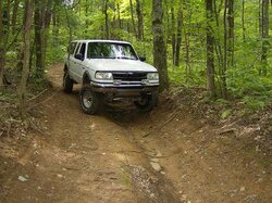
Here's a shot from the shake-down run today...
 

Attachments

  • Unicoy St Park small.JPG
    Unicoy St Park small.JPG
    68.7 KB · Views: 405


Well i finally got my SOA and shackle swap done. Also welded on my new tow points in front. Now just need to install my new inner axle seals, and drop the t-case to re-seal. Would like to also get new driveshaft u-joints installed to. And I should be ready to hit the highways on Mon. Would be nice to test it out first.


Chad- yopu should definatley at least take it out for 1-2hr drive, if u bring it to Linn on Sunday we can make sure its all working properly :)


I drive it everyday, it is still my daily driver. I just have not had a chance to flex it out or see how it does offroad since the SAS. And would like see what it is like climbing and having the ARB up front. It looks like maybe a day trip to Linn,MO may be needed, since you have your own trails.


I have an SWR meter if you need me to bring it.


Join the Elite Explorers for $20 each year or try it out for $5 a month.

Elite Explorer members see no advertisements, no banner ads, no double underlined links,.
Add an avatar, upload photo attachments, and more!
.


Hmm I might need some fine tuning on my c/b as well, not sure isnt hooked all the way up yet, ah the list of stuff to still do!


Status
Not open for further replies.
Back
Top